 KalervoK · CC BY-SA 3.0
 Why visit
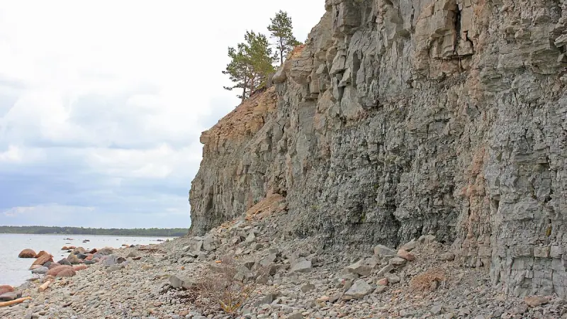
Panga Cliff is a good place to see Saaremaa’s geology directly in the coastal landscape. The cliff line rises sharply above the Baltic and reveals the layered limestone characteristic of western Estonia. Paths and viewpoints offer broad sea views, but the unguarded natural edge requires care and conditions can be windy. The site pairs well with Angla and northern-island villages because it replaces built heritage with a large-scale natural feature and shows how the island’s bedrock shapes its coastline.
What you will see
- limestone cliff face.
- Baltic Sea panorama.
- layered bedrock.
- coastal grassland.
History
The cliff is part of the Silurian limestone landscape of Saaremaa and was formed through long-term marine and glacial processes. It extends for several kilometres, with the highest section rising a little over twenty metres.
Visitor tips
- 1
Allow enough time to explore the setting rather than only the principal feature, and follow local signs where routes, protected areas or historic surfaces limit access.
About Saaremaa & Muhu
Estonia’s largest island region mixes medieval Kuressaare, meteorite geology, windmills, limestone coast and traditional Muhu villages.
Open the Estonia guide